| Bing Maps V8 Control |
| Written by Kay Ewbank | |||
| Friday, 15 April 2016 | |||
|
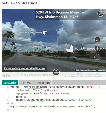
There's a new version of the Bing Maps control with improvements including spatial analytics tools and Streetside imagery. The Bing Maps v8 control lets you add maps to your applications and display data with a spatial element. The improvements to the new version are mainly to let you offer more interactive maps and data visualizations. The control has Autosuggest so will provide suggestions dynamically as the user types a location in a search box. The streetside imagery is also new, so that you can provide 360 degree spin around showing street view images.
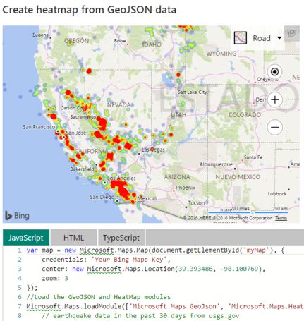
Support has been added for clustering, so where data points are close together, the pushpins showing where the locations are will overlap, and group and ungroup automatically as users change the zoom level. A new heatmap display has been added so you can show the density of data points as a heatmap. There's also a new spatial math module with operators that can be used to calculate distances and areas, or for more abstract uses such as performing boolean operations on shapes. Administrative boundary data is now available, and GeoJSON support has been added making it possible to import and export GeoJSON data.
There's an interactive SDK where you can try out the new features. Alongside the new version of the map control, Microsoft has released an update to Bing Spatial Data Services (SDS). This lets you upload, host and expose your data as a spatial REST service, so it can be used in any application without having to develop your own custom web service. SDS also supports batch geocoding and reverse geocoding, and provides the ability to access administrative boundary data such as polygons for zip codes, cities, and countries. The new features in SDS mean you can create custom data sources using KML and Shapefiles. Shapefiles can also be automatically projected into the WGS84 Mercator projection used by Bing Maps, making the data easier to visualize on Bing Maps.
More InformationRelated ArticlesDeep Learning Powers BING Voice Input SDK for Bing Spatial Data Services Bing Maps for Metro Style Apps Getting Started With Google Earth Getting started with Google Maps JavaScript An Interactive Google Earth KML Editor Getting started wth Bing Maps (Virtual Earth) Where are you from? IP Geolocation
To be informed about new articles on I Programmer, sign up for our weekly newsletter,subscribe to the RSS feed and follow us on, Twitter, Facebook, Google+ or Linkedin.

Comments
or email your comment to: comments@i-programmer.info |
|||
| Last Updated ( Friday, 15 April 2016 ) |