| Not The Shortest Way Home - But The Safest |
| Written by Lucy Black | |||
| Saturday, 22 September 2018 | |||
|
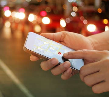
We talk a lot about how self-driving cars might save lives, but perhaps there are other ways of making things safer for drivers and pedestrians. Researchers from Cardiff University have been investigating how best to compute the safest way home.
Maps are everywhere and since maps moved to digital we have been able to do difficult things like compute the shortest route between two locations - but distance is not the only metric. "Each year about 1.24 million deaths worldwide result from road traffic crashes, making this the eighth leading cause of death globally." It is estimated that about 25% of all road traffic deaths are pedestrians. I don't know about you, but when I'm working out how to get from one place to another I often consider how difficult and dangerous a route is. Most of the time that consideration is unconscious - I just prefer one route to another and the preference sometimes isn't just for the quickest or shortest route. Avoiding dangerous roads, difficult crossings or reducing the number of crossings is also something to take into account. And yet when you ask Google Maps, say, for a route you get the shortest and not the safest. In a new study, published in the journal Accident Analysis and Prevention, researchers have shown how a novel system for scoring the safety of an area can successfully predict the likely number of road casualties. The scoring of the routes is done automatically, "We propose a novel linear model of pedestrian safety in urban areas with respect to road traffic crashes that considers a single independent variable of pedestrian path safety. This variable is estimated for a given urban area by sampling pedestrian paths from the population of such paths in that area and in turn estimating the mean safety of these paths. We argue that this independent variable directly models the factors contributing to pedestrian safety. This contrasts previous approaches, which, by considering multiple independent variables describing the environment, traffic and pedestrians themselves, indirectly model these factors. Using data about 15 UK cities, we demonstrate that the proposed model accurately estimates numbers of pedestrian casualties." There are plans to turn the model into an app, but I'm not convinced how successful it would be. Will people actually take a longer but marginally safer route? It seems more likely that road planners and planners in general would be better placed to make use of the model to improve road safety and concentrate on pedestrian danger spots. It does raise the idea of a whole class of apps however. What about safe bike routes and even safer car routes. The real question is would users value safety? More InformationA computational model of pedestrian road safety: The long way round is the safe way home Charlotte Hannah, Irena Spasić and Padraig Corcoran (Shamefully the paper is behind a paywall)
Related ArticlesFinding Beautiful Walking Routes Create Your Own Google Street View The XY Traveling Salesman Problem Solved The Physical Travelling Salesman Challenge To be informed about new articles on I Programmer, sign up for our weekly newsletter, subscribe to the RSS feed and follow us on Facebook or Linkedin. 
Comments
or email your comment to: comments@i-programmer.info |
|||
| Last Updated ( Saturday, 22 September 2018 ) |