| ESRI Relaunches ArcGIS For Devs |
| Written by Kay Ewbank | |||
| Tuesday, 05 February 2019 | |||
|
ESRI has relaunched ArcGIS for Developers, making it cheaper and easier to access. The facilities for developers deploying commercial apps have also been revamped. ArcGIS is a platform for creating, managing, sharing, and analyzing spatial data. ArcGIS is made up of server components, mobile and desktop applications, and developer tools. It can be deployed on-premises or in the cloud (Amazon, Azure) with ArcGIS Enterprise, or used via ArcGIS Online which is hosted and managed by Esri. There's a portal with a web UI and APIs for publishing, sharing, and managing content, maps, applications, and users.
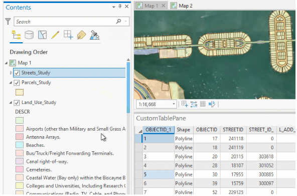
The way developers work with ArcGIS has been changed, with a new pay-as-you-go plan under which you pay only for services you use. The price of routing services has also been reduced, from US$4.00 per 1,000 routes to US$0.50 per 1,000 routes. You now also get a commercial app deployment license at no additional cost, as it is included in the paid developer subscription, so you can deploy revenue generating apps without having to buy an additional deployment license. Alongside the relaunch, there's a new version of the ArcGIS Pro SDK, with new features including a new table control and the ability to customize maps via the CIM (Common Information Model). The table control means multiple attribute tables from multiple maps can be visualized from within a custom pane.
The Geodatabase API has a new plug-in data sources project template for creating new data formats which behave like read-only tables and feature classes; and the Layout API now has map series creation and export support. meaning you can export multipage maps. The MapSeries class provides a method that generates a spatial map series for a given layout. There's a new Dimension API that lets developers work with dimension feature classes - collections of text features with a common set of attribute columns and class level properties. The Content API has additional support for metadata, and a preview version of the ArcGIS Pro Extensions using NuGet has been included.
More InformationRelated ArticlesGoogle Maps API Changes Billing Rules Building Geo-tracking Apps with AngularJS, Ionic, and the Salesforce REST API To be informed about new articles on I Programmer, sign up for our weekly newsletter, subscribe to the RSS feed and follow us on Facebook or Linkedin. 
Comments
or email your comment to: comments@i-programmer.info |